Katina’s Ghost
Exploring the intersection of hidden history, advanced sensing and clandestine fieldwork to uncover a long‑forgotten story.
Introduction
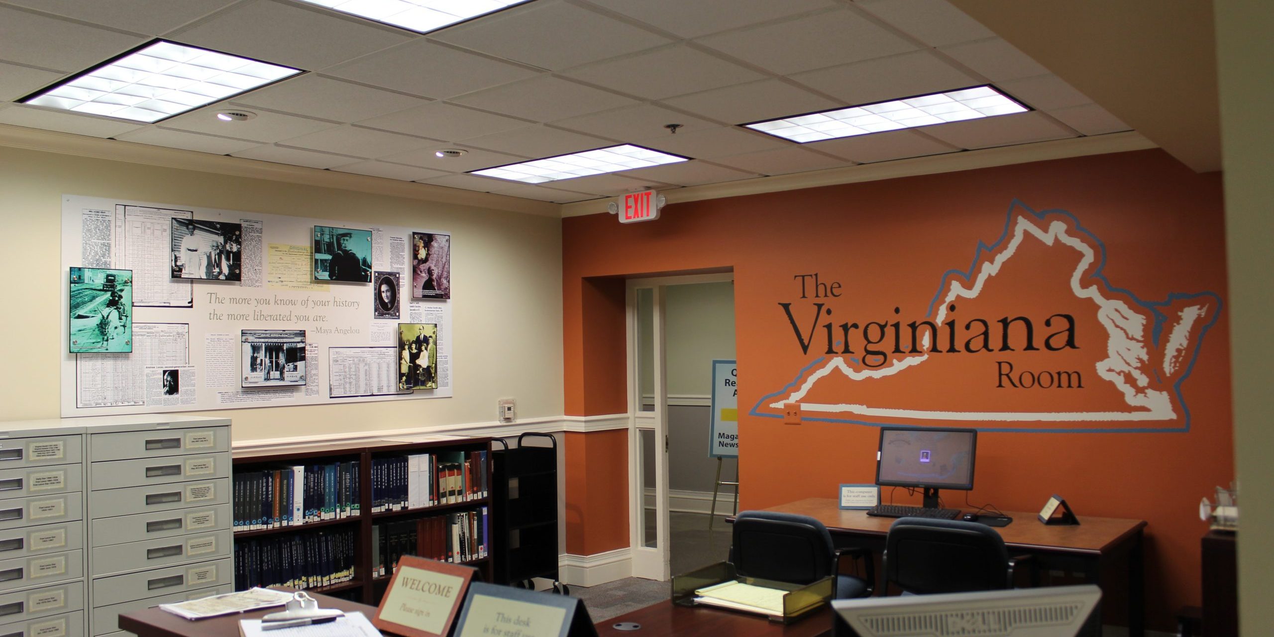
Katina’s story begins with a daring act of research and ends with a mission to honour a forgotten life. While combing through the restricted stacks of the Virginia Room archives at the Central Rappahannock Regional Library, our team encountered a hand‑drawn map and cryptic references to an Indigenous woman interred somewhere on a private estate. Curiosity turned into obsession. We quietly digitised and extricated fragile records to create our own private collection, piecing together scattered references from letters, wills and newspapers.
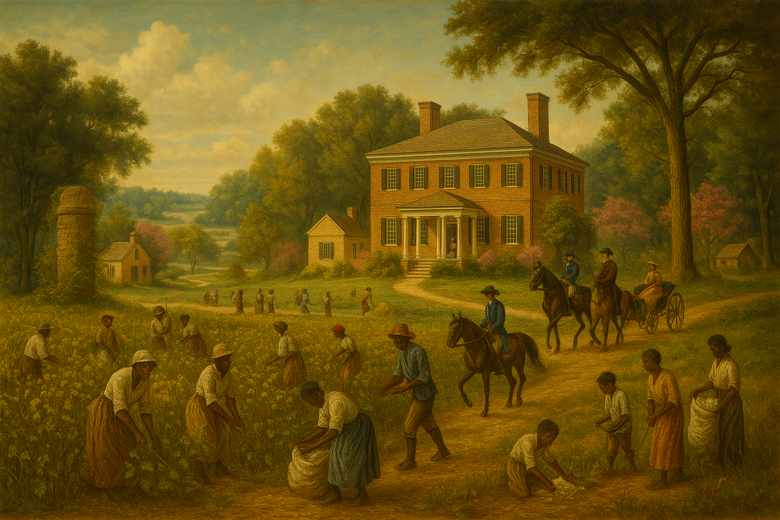
Those sources revealed an extraordinary narrative: in the early 1700s a young girl from a Siouan‑speaking nation was taken captive during frontier conflict and sold into the household of Lieutenant Governor Alexander Spotswood. She was called Katina. After Spotswood’s death, she passed through his family as property and ultimately accompanied Anne Thompson when she married Francis Thornton of Fall Hill in 1759. At that remote plantation above the Rappahannock River, Katina became more than a servant—she raised several generations of Thorntons, taught children to fish, forage and speak her language, and passed on Indigenous knowledge of plants and the land.
The area around Fall Hill is mysterious because it blends myth, memory and physical traces. Local lore speaks of a benevolent ghost watching over sleeping children. Historical documents hint at a secret grave marked only by periwinkle vines under towering oaks. Advanced LiDAR analysis uncovers terraces and roads carved into the hillside that match centuries‑old maps. Our mission is to synthesise these elements—archives, sensing and field recon—into an actionable intelligence report.
Biographical Timeline
The Story of Katina
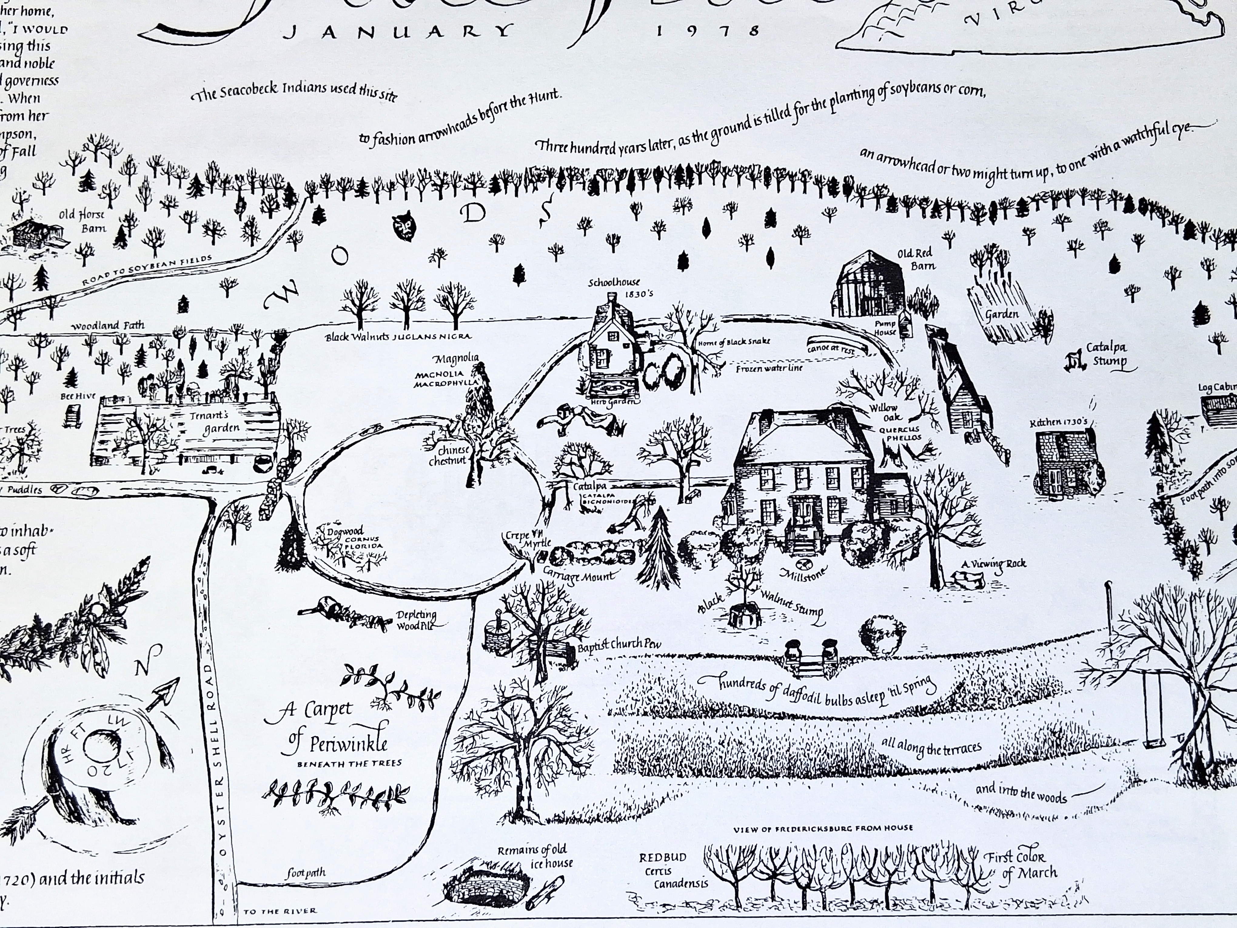
This whimsical 1978 map sparked our quest. It depicts the Fall Hill estate with gardens, barns and a circle labelled “A carpet of periwinkle beneath the trees.”
- ca. 1700: Born into a Siouan‑speaking nation somewhere west of the Virginia fall line. Oral tradition calls her a “princess,” but surviving documents describe her as Catina, a girl of mixed Indigenous and European heritage captured in a raid.
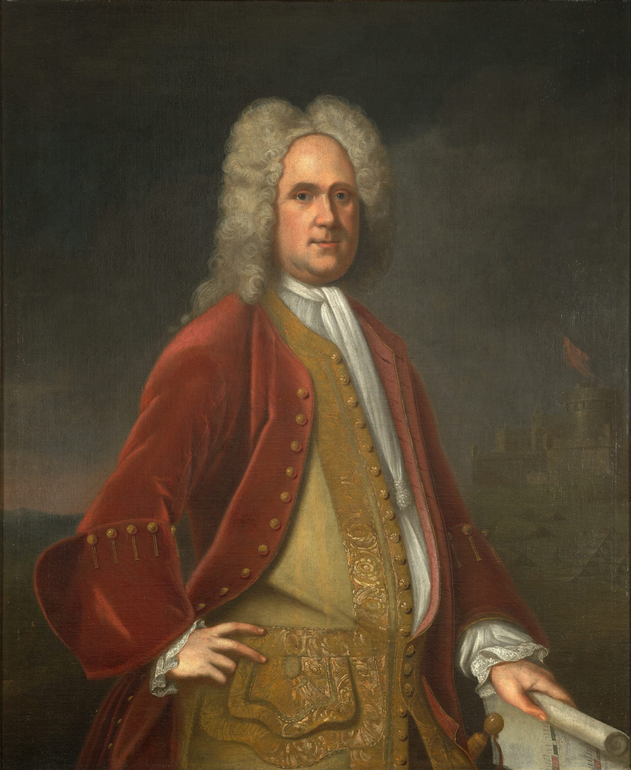
- 1710s–1720s: Governor Alexander Spotswood acquires her as an enslaved household servant. Contemporary travellers note that Spotswood’s wife treats Katina with unusual respect and generosity.
- 1740s: Upon Spotswood’s death, Katina passes through the Moore family’s inheritance and eventually attends the childhood of Anne Thompson.
- 1759–1760: Anne Thompson marries Francis Thornton IV. Katina travels with her to Fall Hill, a plantation above Fredericksburg. She becomes the nursemaid and governess to the Thornton children, imparting Indigenous words, herbal medicines and wilderness skills.
- 1760s–1770s: Katina raises three generations of Thorntons, taking the children on summer expeditions through the woods and teaching them to interact with birds and plants. Her influence is so profound that Francis Thornton later calls himself “always a friend of the Indians.”
- 1777: Katina dies at an advanced age. The Thorntons quietly bury her beneath six massive oaks on a terraced slope of Fall Hill, marking the spot only with a plain granite stone and a carpet of periwinkle.
- 1800s–Present: Descendants recount sightings of a gentle, braided‑hair woman watching over sleeping children. Tour guides adopt the story of “Katina’s ghost” as part of Fredericksburg lore.

Artist’s interpretation of Katina as a young woman in the 1740s.
Life in the Thornton Household
Though legally enslaved, Katina occupied a singular role at Fall Hill. She became the children’s surrogate mother, teaching them to speak Indigenous words, identify edible plants and navigate by the stars. Eyewitness accounts describe her leading the youngsters into the woods for weeks, living off fish and berries while telling stories of her homeland. Birds and deer reportedly responded to her calls, captivating the children and connecting them to a deeper knowledge of the natural world.
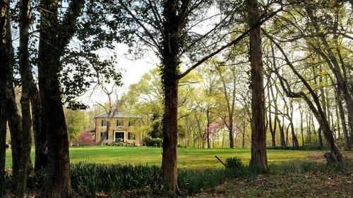
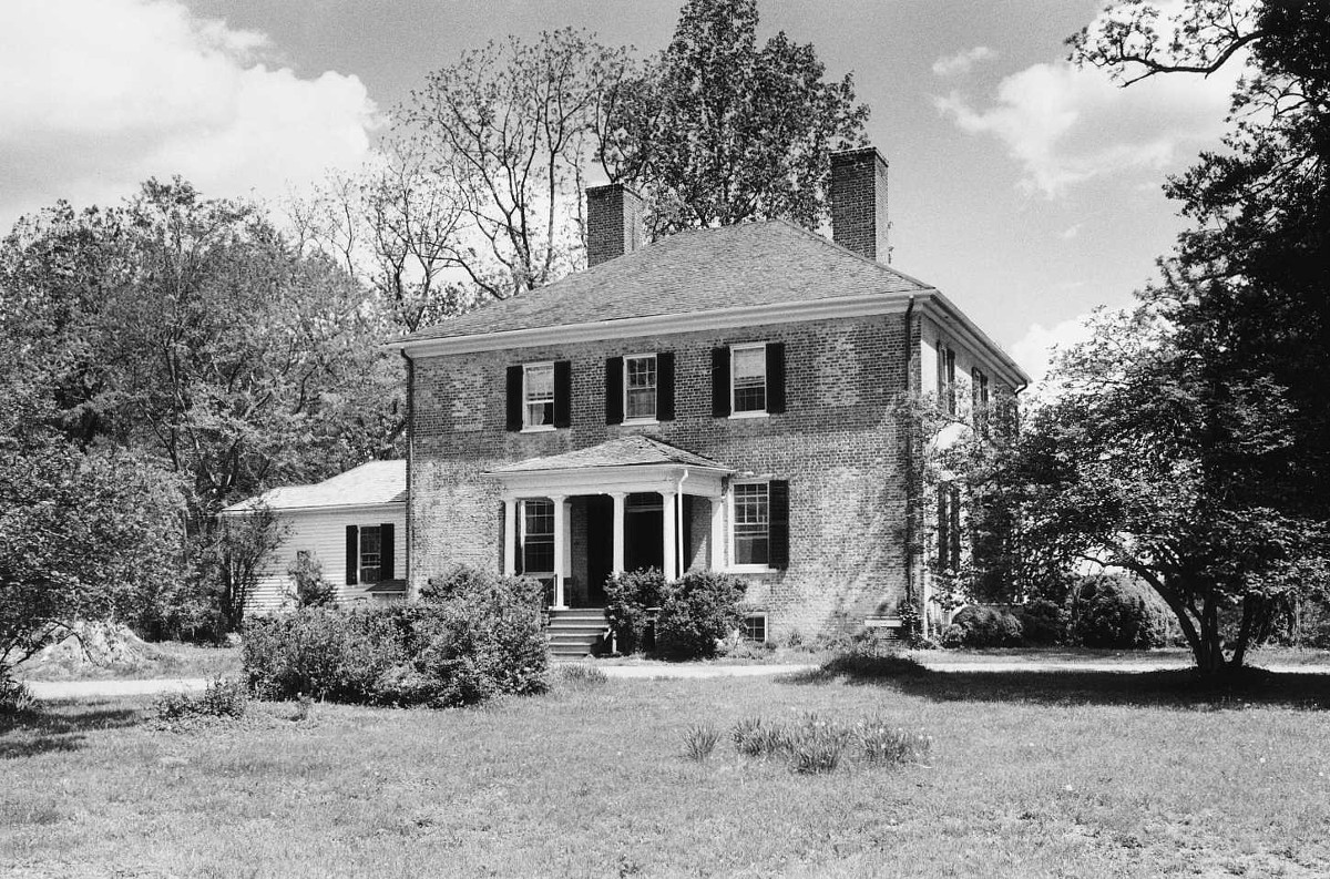
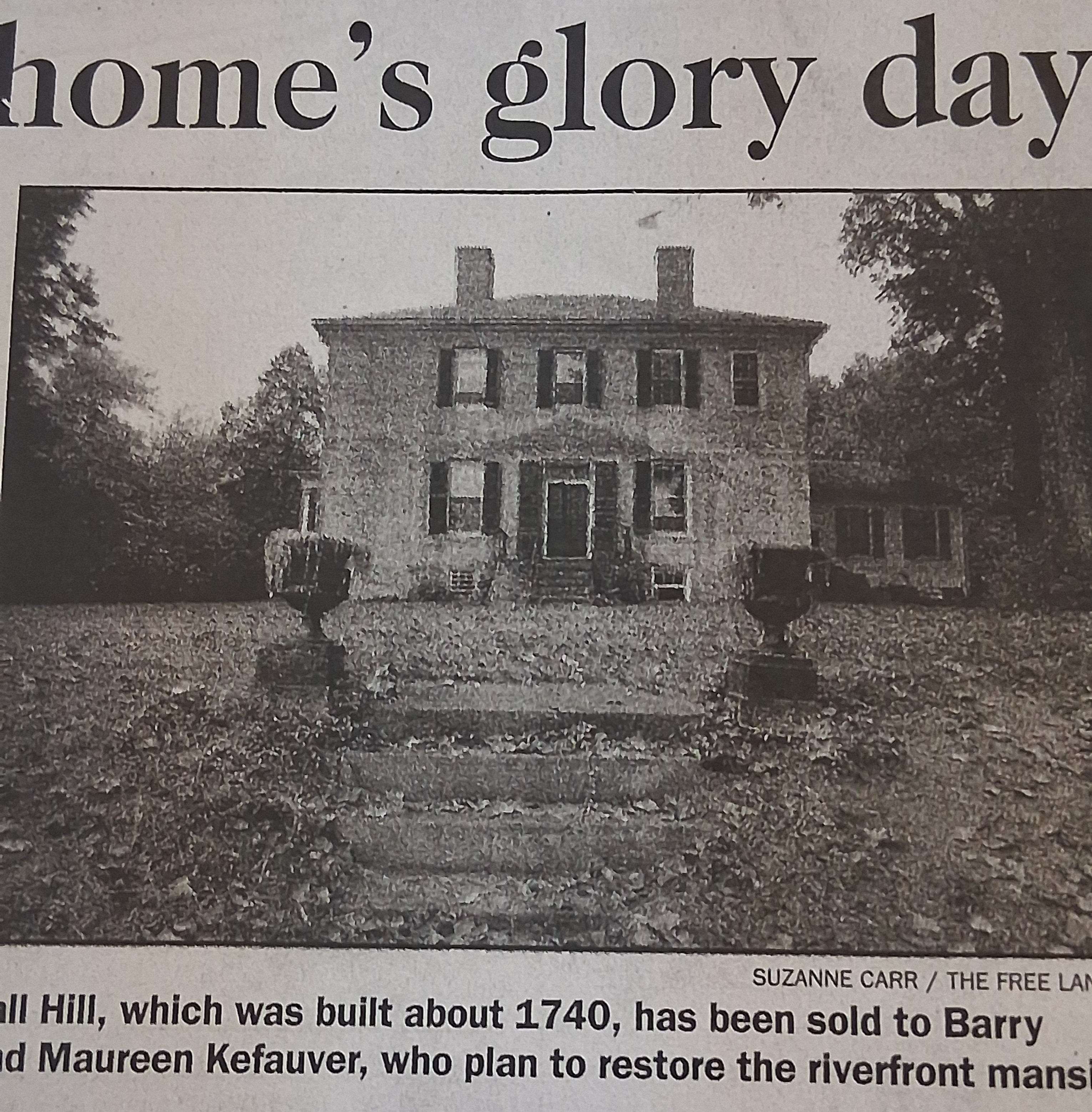
Fall Hill Estate
The main house at Fall Hill was a Georgian brick mansion built in the 1790s overlooking the Rappahannock. Katina lived in a detached kitchen cottage nearby.

Servant Cottage
This humble outbuilding—sometimes called the old kitchen or school house—served as Katina’s residence. It has recently been stabilised with preservation grants.
Death & Legacy
Katina’s death in 1777 did not sever her connection to Fall Hill. The Thorntons, constrained by slave‑holding norms, could not memorialise her with a carved epitaph. Instead they selected a secluded terrace beneath six venerable oak trees and gently lowered her into the earth. They planted periwinkle to cover the grave and placed an uninscribed granite slab so as not to draw attention. Only immediate family members knew the spot; the grave remained an intimate secret for two centuries.
Yet the absence of a marker did not prevent Katina from becoming a legend. Stories of a benevolent ghost—slim, dark‑haired and plainly dressed—circulated throughout Fredericksburg. Descendants and visitors reported feeling a gentle hand brushing their forehead when sick or spotting a woman’s silhouette in the nursery. Whether supernatural or metaphorical, the enduring presence of Katina in local memory underscores how an enslaved Indigenous woman transcended erasure to shape regional identity.
How We Found Katina
Our mission originated in the dimly lit basement of the Central Rappahannock Regional Library. The Virginia Room contains collections rarely accessed by the public. After politely requesting materials, we spent hours leafing through brittle genealogies, local newsletters and obscure legal papers. An annotated 1978 map titled “The Story of Katina” caught our eye. Its whimsical illustrations depicted Fall Hill’s gardens, barns and a mysterious circle labelled “A carpet of periwinkle beneath the trees.” That clue, coupled with a tattered newspaper clipping about a ghostly nanny, set us on this path.
We quietly photographed and scanned every relevant document, building a private digital archive. Over weeks, we cross‑referenced names and dates from wills, tax records and oral histories. The pieces aligned: the periwinkle patch on the map corresponded to a terrace visible in modern LiDAR data; the ghost stories matched family letters; the granite stone matched a plain marker noted in a 1990 historic resources survey. These convergences galvanised us to search for Katina’s final resting place.
Source Documents from Archives & Internet Research
Our evidence base combines original archival materials with online genealogy, newspaper archives and ghost‑story blogs. Highlights include a hand‑drawn plan of Fall Hill showing terraces, orchards and the periwinkle circle; an early 20th‑century newspaper clipping about a phantom caretaker; Spotswood family wills mentioning an enslaved girl named “Catina”; and oral histories recorded by descendants.
Fall Hill Map (1978)
The whimsical map that started it all. It labels gardens, barns and a mysterious periwinkle patch.
Newspaper Clipping
This newspaper story recounts a ghostly nanny protecting children at Fall Hill, reinforcing oral traditions.
Further reading:
Ghost Nanny of Fall Hill Plantation – Part 2 and Virginia Family Cemeteries Survey (page 153) and Slaves of Fall Hill: Abraham and Hester Tuckson and NANNY OF FALL HILL - FREE LANCE STAR ARTICLE.The Quest for Katina’s Grave
Locating a centuries‑old grave without disturbing the land is both a technical and ethical challenge. We employ open‑source intelligence, publicly available elevation data and careful field observation to approximate the burial without excavation. By aligning the 1978 map’s periwinkle circle and oak grove with modern terrain models and surviving road traces, we narrow the search to a specific terraced slope above the Rappahannock. Our goal is to confirm the grave’s location respectfully and eventually help protect it.
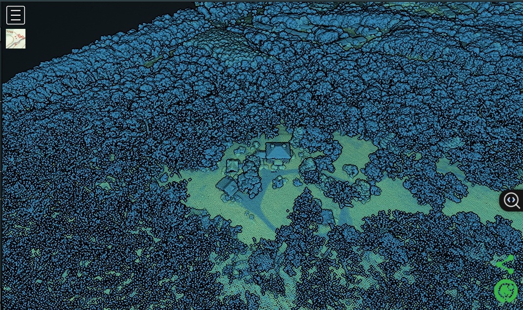
Katinis Grave LiDAR Anomaly
High‑resolution LiDAR imagery reveals a subtle mound on the terraced slope of Fall Hill that aligns with the periwinkle patch marked on the 1978 map. This “candidate grave mound” became the focus of our night‑time reconnaissance.
Official records corroborate our hypothesis. A 1990 survey by the Virginia Department of Historic Resources describes Katinis Grave as follows:
Name of Cemetery: Katinits Grave … Location: On property of historic Fall Hill, 3315 Fall Hill Ave., Fredericksburg, approx. 1,000 yards from the main house on the little farm road that branches off from the right of the main road to the house. … Dates: 1777. Number of graves: One. Condition: No marker on grave. An old oak has fallen over the grave and its sister oak has also fallen, and the hill is covered with brush and brambles. Comments: Katini was a famous servant of Governor and Lady Spotswood. She was well known in the community and the cottage where she lived called the old Fall Kitchen has recently been endowed with a grant by Virginia Landmarks. Ghost stories about Katini abound. The “Indian Maiden,” Katina, was brought back from a journey into the Blue Ridge Mountains by the Knights of the Golden Horseshoe by Francis Thornton.
LiDAR Analysis
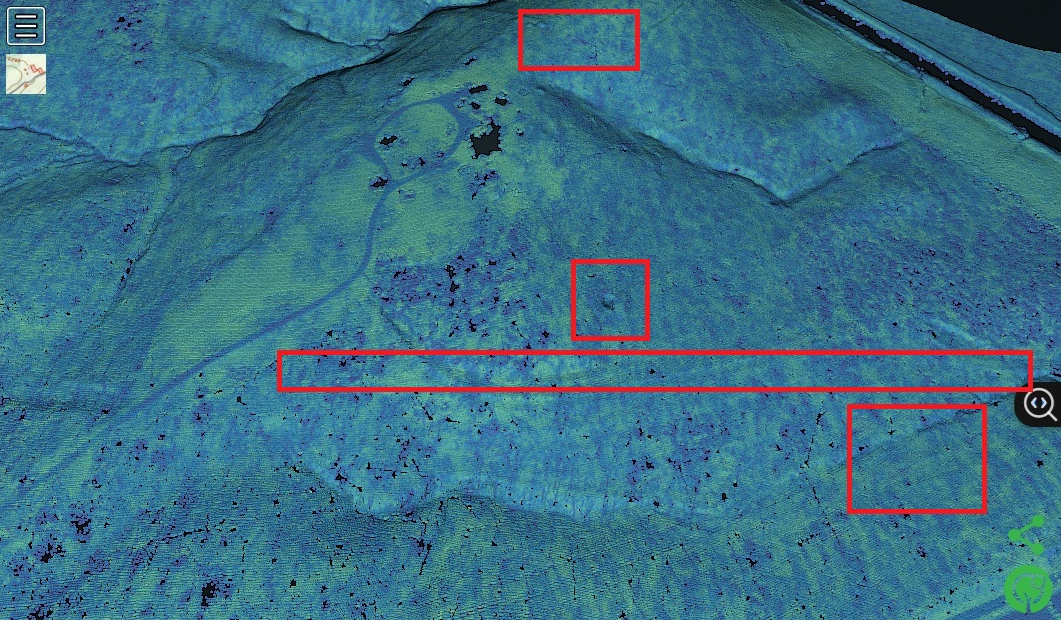
Public domain LiDAR from the U.S. Geological Survey (AWS Northern Virginia B22 tiles) allowed us to peel away the forest canopy and visualise Fall Hill’s micro‑topography. Instead of a single summary, we break our analysis into specific sub‑regions to show how each feature informed the hunt.
Fall Hill Estate
The mansion at Fall Hill sits on a high bluff overlooking the river. LiDAR imagery highlights the broad plateau carved out for the house and gardens.

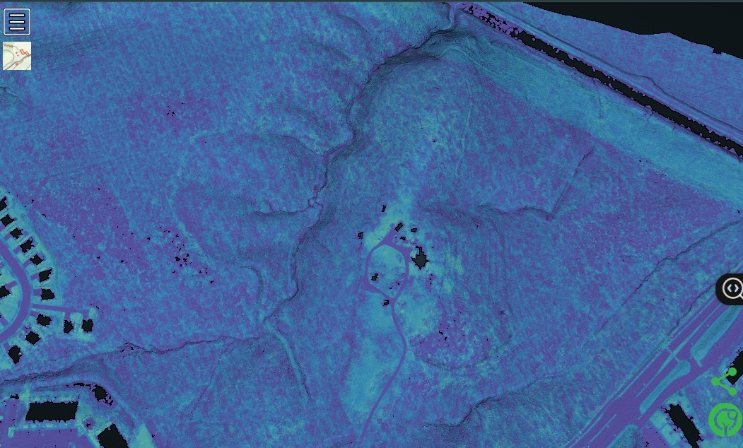
LiDAR w/out Trees/Buildings
LiDAR image of the estate without trees and buildings, revealing its outline and position relative to the terraces.
Terrace Slopes
A series of engineered steps cut into the hillside mirror the “hundreds of daffodil bulbs asleep all spring” noted on the 1978 map. These terraces likely date to the plantation era and guided our search for the grave. Compare the high‑lighted features with the bare‑earth model to see how terraces define the terrain.
Oyster‑Shell Road
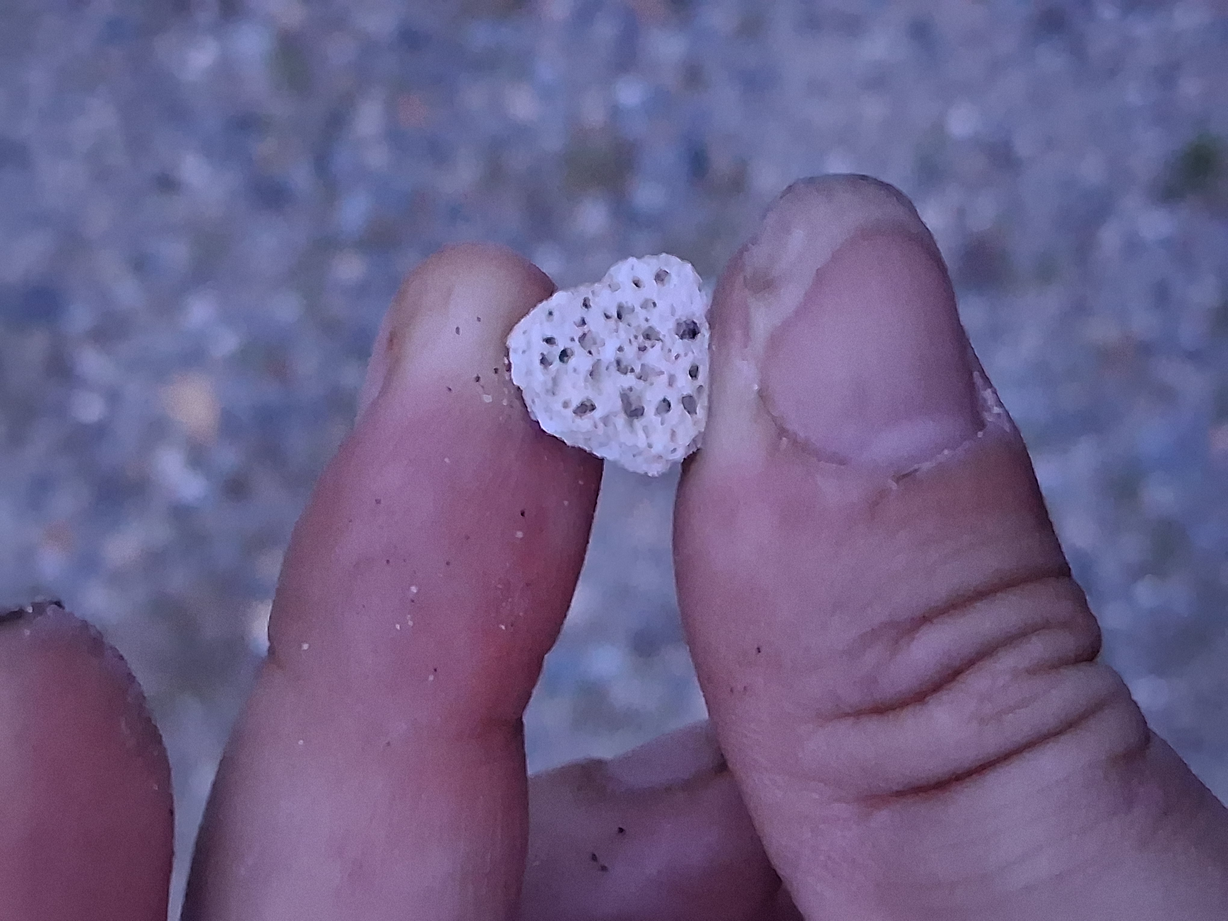
The 18th‑century carriage road from the manor to the river was surfaced with crushed oyster shells. LiDAR shows it as a linear depression running down the hill. During the Civil War this roadbed doubled as a trench line for Confederate artillery. The image below highlights its course.
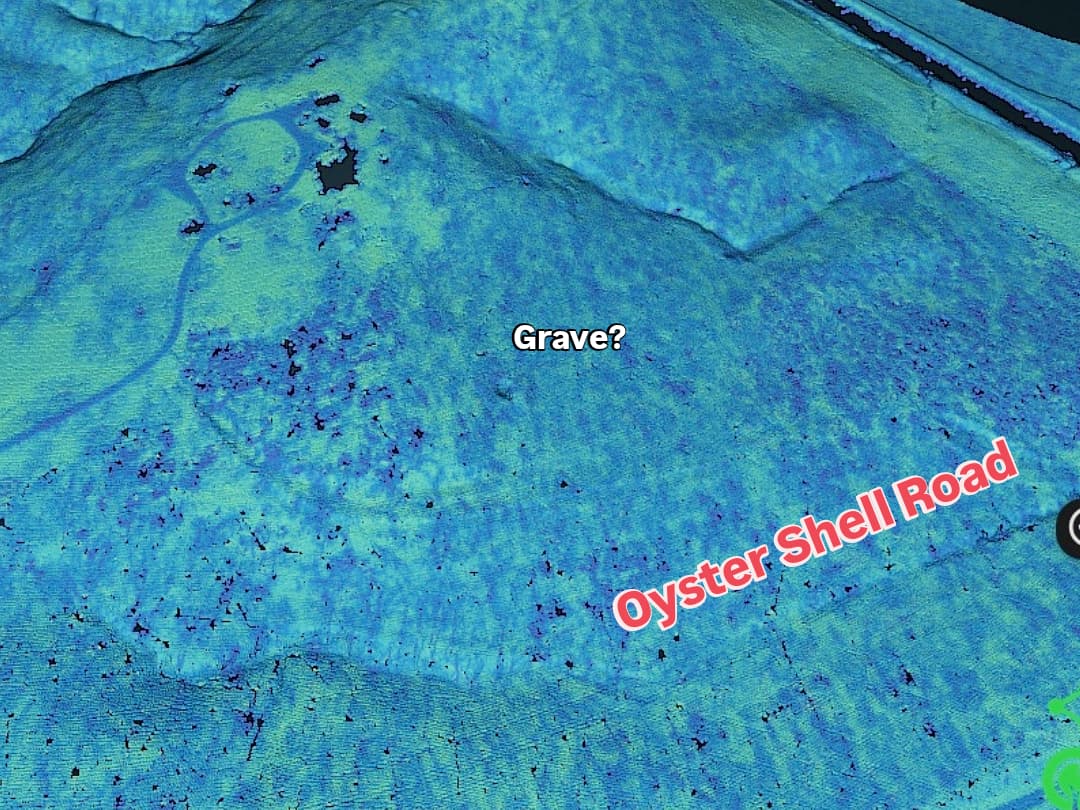
Candidate Grave Mound
Within the terraced area, LiDAR reveals a subtle, circular elevation aligning with the periwinkle circle on the 1978 map and matching oral descriptions of the grave’s location. Surrounding points show heavy tree cover, consistent with the oak grove noted in family lore. The image below pinpoints this candidate mound.
These remote‑sensing insights illustrate how modern technology can recontextualise historical narratives. The same methodology could be applied to other hidden grave sites, battlefields or long‑lost settlements.
Visiting the Site in Person (Night Ops)
Armed with our analysis, we executed a series of clandestine field excursions to Fall Hill under cover of darkness. We chose night hours to avoid detection and to minimise the risk of disturbing residents or wildlife. Our objectives were to verify the location of the terraces and oyster‑shell road on the ground, confirm the presence of periwinkle and ancient oaks at the candidate grave site, and assess access routes, security measures and potential hazards (feral dogs, foot traffic, homeless encampments).
Preliminary Reconnaissance
We began with distant observations, scouting from across the Rappahannock and down old farm lanes. These surveys helped us plan ingress routes and identify locked gates or posted property lines.
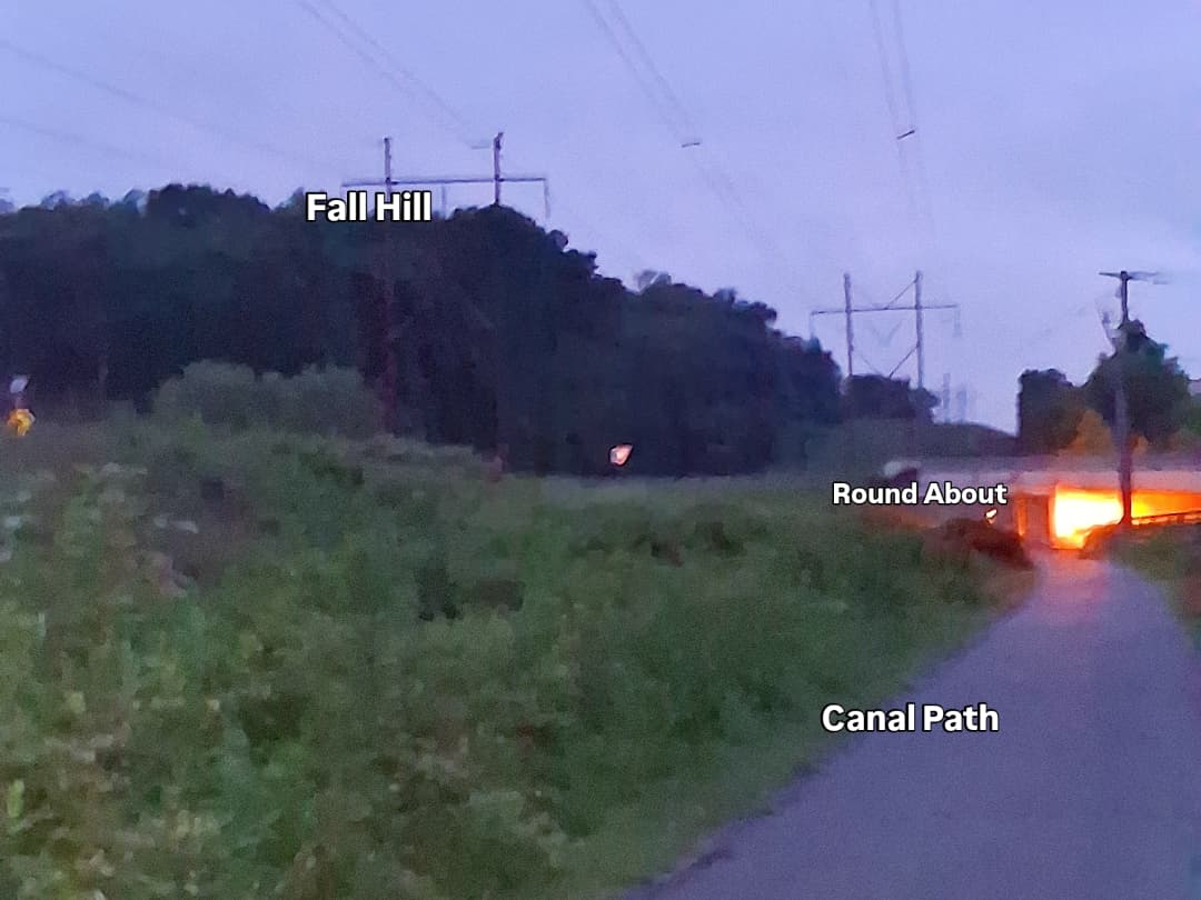
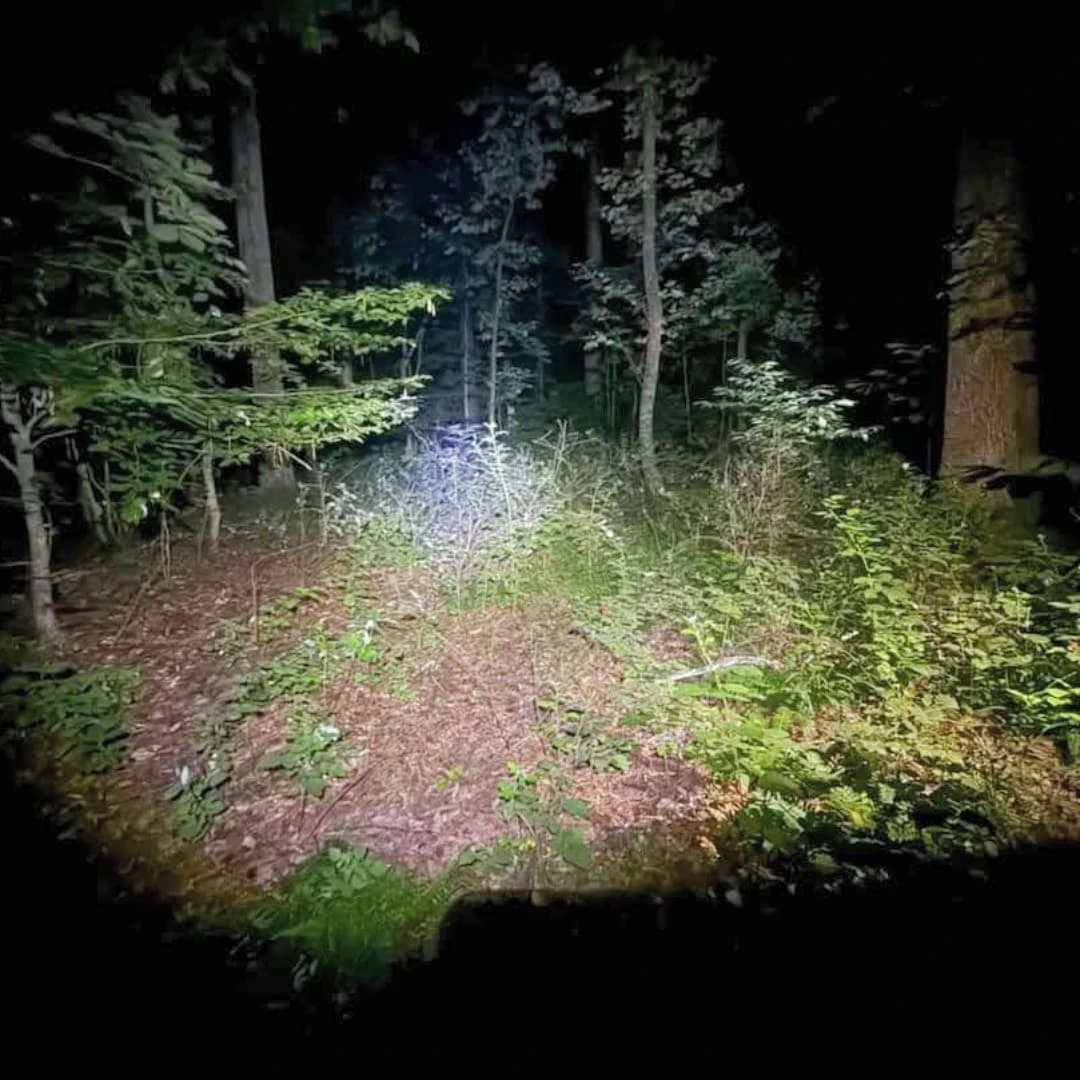
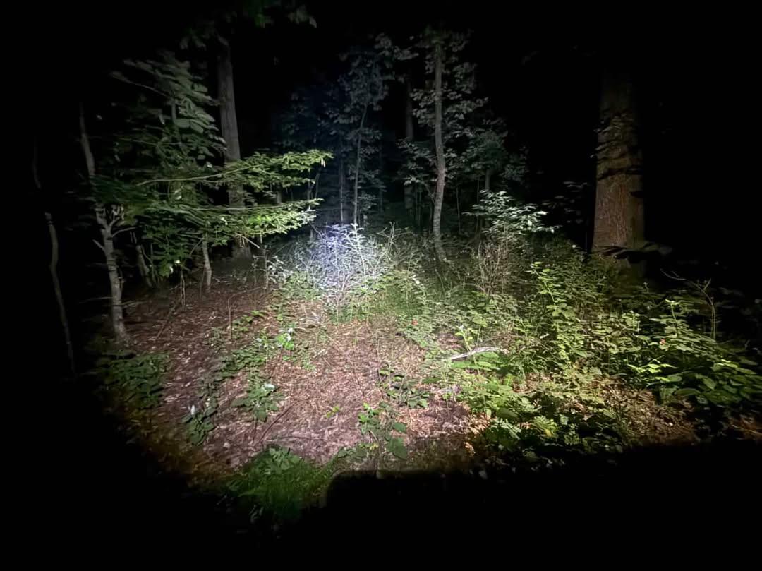
"Approaching Fall Hill at night"
Gear Prep & Avoiding Detection
Each mission required careful gear preparation. We used flashlights with red lenses, cameras with infrared capability, GPS units loaded with LiDAR‑derived waypoints, and first aid kits. To avoid detection, we wore dark clothing, minimised noise and kept our lights shielded except when navigating hazards. We also briefed on hazards such as feral dogs, uneven terrain, and potential encounters with homeless camps.
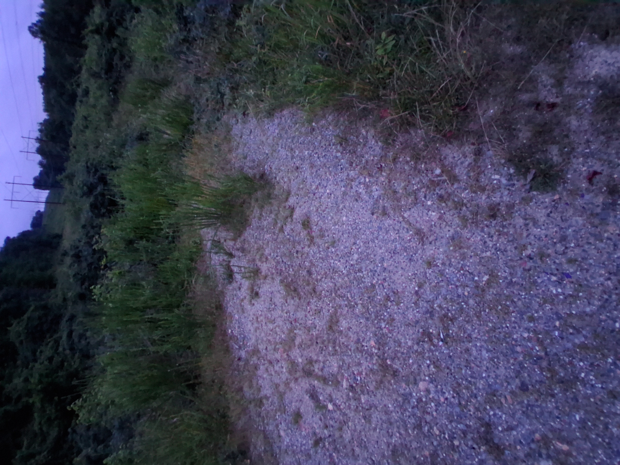
Intel Collection & Confirmation
At the site we moved slowly, cross‑checking our GPS positions against the LiDAR overlay. We located the terraces and the oyster‑shell road exactly where the models predicted. We found a patch of evergreen groundcover and two massive oaks at the suspected grave locus, confirming the periwinkle and oak clues. No digging was performed – our aim was observation only. We also noted signs of trespass and trash, highlighting the need for stewardship.
"The Original Stone Gate"
"Exploring the abandoned path"
"The Re-Discovery of Oyster Shell Road!"
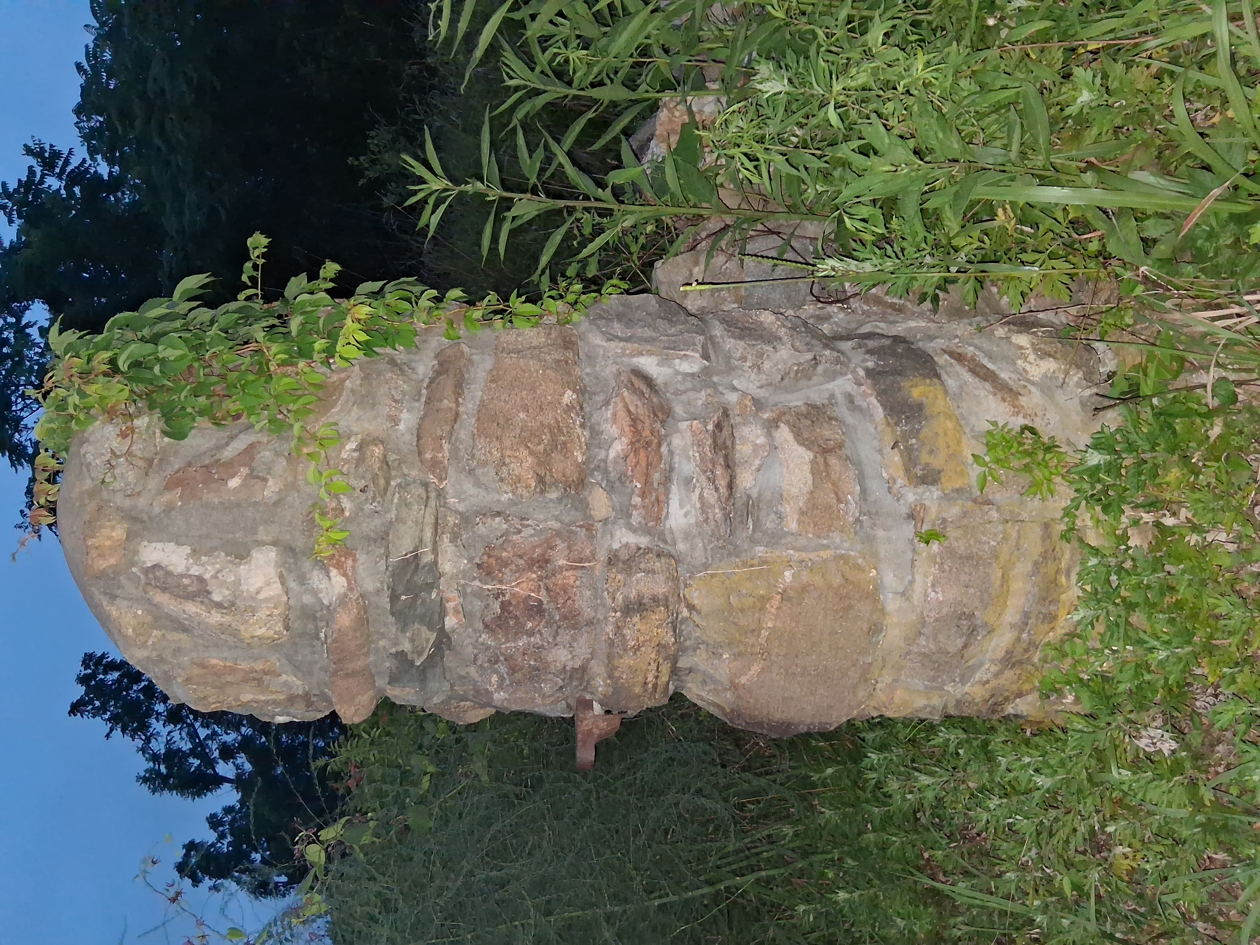
Our Discovery
On the final reconnaissance, we located a patch of evergreen groundcover adjacent to a fallen oak trunk that matched every element of the story. Low, glossy leaves of Vinca minor—known colloquially as periwinkle and traditionally planted on graves—spread across the forest floor. Nearby stood two massive oak trees and remnants of others. The soil was subtly raised in an oval shape, though centuries of leaf litter made it difficult to discern. We detected no inscribed headstone, but the field alignment, vegetation and topography correspond precisely to the 1978 map and LiDAR anomaly. The area is currently littered with debris and overgrown brush, a sobering reminder of how easily such sites are forgotten.
Gravesite Location
A moss‑covered mound with two ancient oaks and a fallen trunk matches the periwinkle patch on the map and LiDAR.

Periwinkle Ground Cover
The glossy evergreen leaves of Vinca minor confirm that this patch was planted intentionally, likely to mark a grave.

Trashed & Overgrown
Unfortunately the gravesite is choked with brush and littered with trash and abandoned camping gear, underscoring the need for conservation.
Conclusion & Future Plans
Our investigation demonstrates how archival research, modern sensing and stealthy fieldwork can resurrect buried stories. At Fall Hill, the grave of Katina—an enslaved Indigenous woman who profoundly shaped a colonial family—likely survives beneath ivy and oaks. The site has been neglected, strewn with garbage and used by transient populations. We believe it deserves preservation and respect.
Moving forward, we plan to secure permission from the property owners to perform non‑invasive surveys such as ground‑penetrating radar (GPR) to conclusively locate the burial. We hope to clear trash, prune invasive plants and erect a modest marker that acknowledges Katina’s life and cultural significance. Moreover, we intend to apply this investigative model to other overlooked sites—combining clandestine archive recovery, high‑resolution terrain analysis and respectful reconnaissance to uncover forgotten histories. By doing so, Athena Intelligence Solutions seeks to illuminate the past and inspire new ways of honouring those whose stories have been hidden.
OAK TREES! WOW. Discovering the massive oaks and periwinkle groundcover brought the legend to life. We intend to return to clean up the area and plant native flowers around the grave, turning a neglected corner into a quiet memorial.